To enable climb the Khakaborazi Mountain, which is considered as the highest snow-capped mountain in South East Asia, Myanmar Hiking and Mountaineering Association members have completed the practicing trip successfully on the peak of Ama Dablam, which is similar closest to Khakkaborazi, in Nepal with full support and sponsorship of Htoo Group of Companies and Htoo Foundation, and have returned to Pangboche village, where they have started the journey.
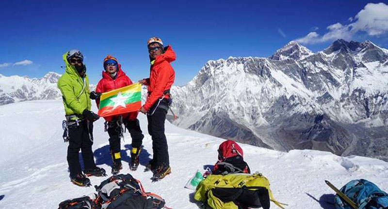
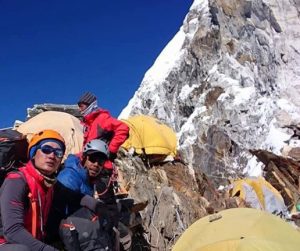
Three members of Myanmar Hiking and Mountaineering Association, Ko Pyae Phyo Aung, Ko Zaw Zin Khaing and Ko Aung Khaing Myint have started the journey on 10.05 hours in the morning and could set foot on the peak of AmaDablam, which is 6812 meters high. After that, they have descended to Camp-2 by 7:00 hours in the evening.
From Camp-2, three Myanmar climbers have descended to the base camp in Panbongche by 3:45 hours in the evening.
Since the three Myanmar mountaineers have arrived safely back to the base camp, it can be said that the journey is fully completed and successful.
As Htoo Group of Companies would like to stress that three Myanmar climbers have raised up the dignity of Myanmar in hiking and mountaineering.
Myanmar Mountaineering Team was able to complete the practicing trip successfully within five days time, and would be arriving back to Yangon on coming 28th November, 2017.
The objectives of the practicing trip for the success of Khakaborazi Expedition Trip are as follows.
As per objective of Htoo Foundation, basic natural tourism will be developed around Putao Region and also the livelihood of the natives in the area. Not only local, but also foreign mountaineers become aware of Khakaborazi and also to develop hiking and mountaineering sports in Myanmar. By developing hiking and mountaineering sports in Myanmar, it can raise Myanmar’s dignity in the world, while it can also support for the development of physical and mental of Myanmar people.
On the other hand, Myanmar Mountaineering Team aims to measure whether 5881 meters high Khakaborazi or 5870 meters high Gamlam Razi is the highest mountain, by using modernized GPS equipments.
Speculation that Gamlang Razi might deserve the title has intensified since 2013, when it was first conquered by a team of American and Myanmar climbers who used GPS equipment to measure its height with precisely. They confirmed it is 5870 meters and the expedition was also sponsored by Htoo Group of Companies.
Mr Takashi Ozaki, a Japanese climber who made the first ascent of Hkakabo Razi in 1996 with Myanmar’s U Nama Johnson, an ethnic Tibetan, confirmed its elevation at 5,881m but was using equipment that predated GPS technology.
Until GPS equipment enabled Gamlang Razi’s elevation to be measured by the team of five United States and two Myanmar climbers who summited the peak for the first time in 2013, maps had shown big variations in its height.
They had ranged from 5,881m, matching that of Hkakabo Razi, on an Indian map, 5,691m on post-World War II Chinese and Russian maps, and 5,758m on a chart in the Harvard Map Collection at Harvard University in the US.
Therefore, it is required to confirm that whether 5881 meter high Khakaborazi or 5870 meter high Gamlam Razi is the highest mountain, only after measuring with modernized GPS equipments.
Htoo Group of Companies is proudly honored to be the main sponsor for such kind of rare opportunity, to be able to confirm which mountain will become the highest in the history of Myanmar Mountaineering Sports and records of geographical records.